
Topography
What is Topography?
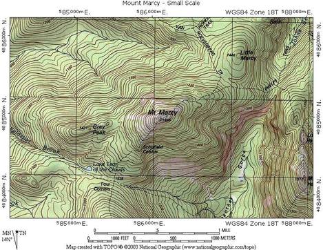
Mapping of elevation
What do topographic maps tell you that other maps can't?
Topographic maps tell us the elevation
Who might use a topographic map (and why)?
Geologists, and pilots use topographic maps because geologists study the earth and pilots need to know where they are going.
Mapping of elevation
What do topographic maps tell you that other maps can't?
Topographic maps tell us the elevation
Who might use a topographic map (and why)?
Geologists, and pilots use topographic maps because geologists study the earth and pilots need to know where they are going.
Define the following
Elevation: the height of a place relative to a reference height.
Contour lines: a line connecting points that have the same elevation
Contour interval: the difference in elevation between two adjacent contour lines
Depression Contour: Contour lines indicating a downward slope (drawn with has marks)
1) which of the topographic maps show two peaks? C. Which side has higher elevation? The left side
2) which topographic map shows the steepest cliff? B. Where is it? on the right side.
Define the following:
Elevation: Height of a place relative to a reference height.
Contour lines: A line connecting points that have the same elevations.
Contour Interval: The difference between two adjacent contour lines.
Depression Contour: Contour lines indicating
Bathymetry: Topography in the ocean- They use sonars to map the ocean.
